Jussi lakes walking track
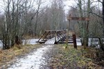 Jussi Lakes are one of the most famous in North Kõrvemaa, unhabitated area south of Lahemaa National Park. Jussi lakes and surroundings are closed to motor traffic, so You have to walk. But You can walk quietly because there are no cars. Track is marked and easy to follow by signs. Several camping places.
Pics from this track
Google Map - track and waypoints.
Waypoints:
- SUURJARV - N59,373694 E025,726840
PARKING - N59,360605 E025,688399 PARKING PLACE / PARKLA
STAND1 - N59,363643 E025,701410
BRIDGE - N59,360600 E025,695327 WALKING BRIDGE OVER SOODLA RIVER.
MUSTJARV - N59,372408 E025,715992
VAINJARV - N59,376788 E025,722502 CAMPING PLACE, TABLE, ROOF, GRILL
KOVERJV - N59,366292 E025,725422 KOVERJARV, CAMPING PLACE, WET
WARNING - N59,362250 E025,726718 SLIPPERY GOING DOWN THE HILL
PIKKJARV - N59,368745 E025,721428 CAMPING PLACE
View Larger Map

jussijarved.gpx - right click to save.
jussijarved.kml - Google Earth File.